

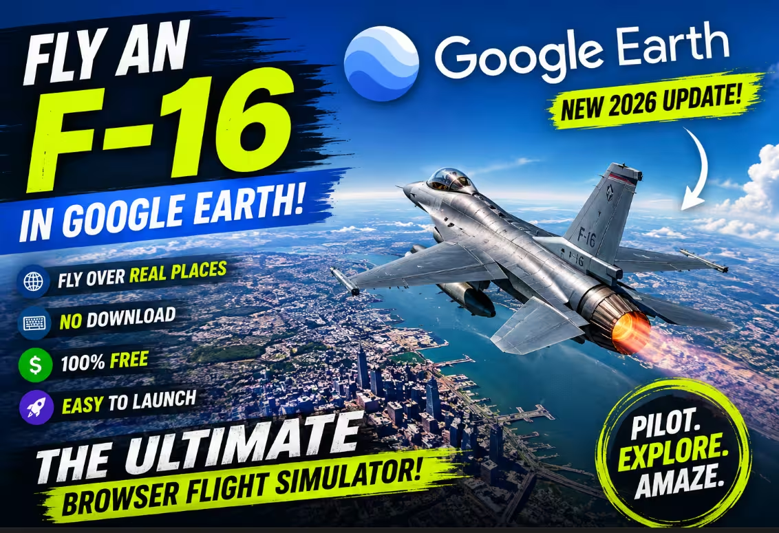
Google Earth Has a Hidden Flight Simulator — And It’s Free
You can now pilot an F-16 jet fighter directly inside your web browser, soaring over real satellite imagery of the entire planet — zero downloads, zero cost.
- Works in any browser
- Real satellite imagery
- Keyboard & mouse controls
- No sign-in required
- Crash & restart anytime
Google Earth Flight Simulator: How to Fly an F-16 Right in Your Browser
What You Need to Know in 30 Seconds
- Google Earth now has a free browser-based flight simulator — previously desktop-only.
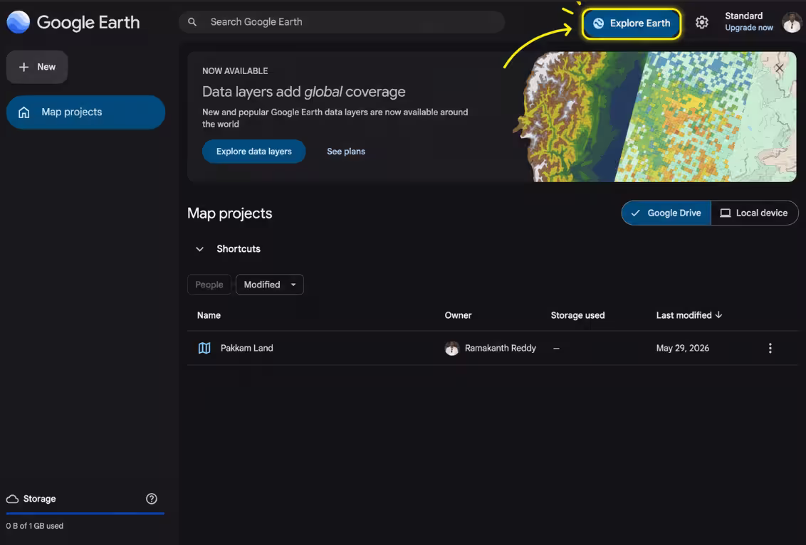
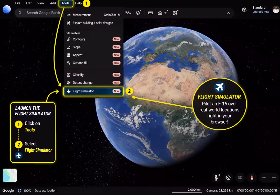
- Go to earth.google.com/web → Explore Earth → Tools → Flight Simulator.
- Switch to Satellite view for the best experience.
- Currently only the F-16 is available in the web version.
- Physics are simplified — this is a sightseeing tool, not a hardcore sim.
- For serious virtual flying, check out GeoFS (geo-fs.com).
Remember when Google Earth was just a way to spy on your neighbor’s rooftop? Those days are long gone. Google has quietly rolled out one of its most entertaining features yet — a fully functional flight simulator built right into the web version of Google Earth. No app install, no Pro license, no credit card. Just open a browser tab and you’re cleared for takeoff.
Up until recently, this hidden gem was locked inside Google Earth Pro, the desktop application. Now anyone with a halfway-decent internet connection can jump into the cockpit of an F-16 and barrel across the Himalayas, buzz over the pyramids at Giza, or do a low pass over their hometown — all from real satellite imagery. Let’s walk through exactly how to do it.

Getting airborne takes less than a minute. Here’s the exact path:
- Head over to earth.google.com/web in your browser.
- Click the “Explore Earth” button in the top-right corner and wait for the globe to fully load.
- Look for the “Tools” menu in the top navigation bar and click it.
- Select “Flight Simulator” from the dropdown — it’s near the bottom of the list.
- The simulator will launch and place you in the cockpit automatically.

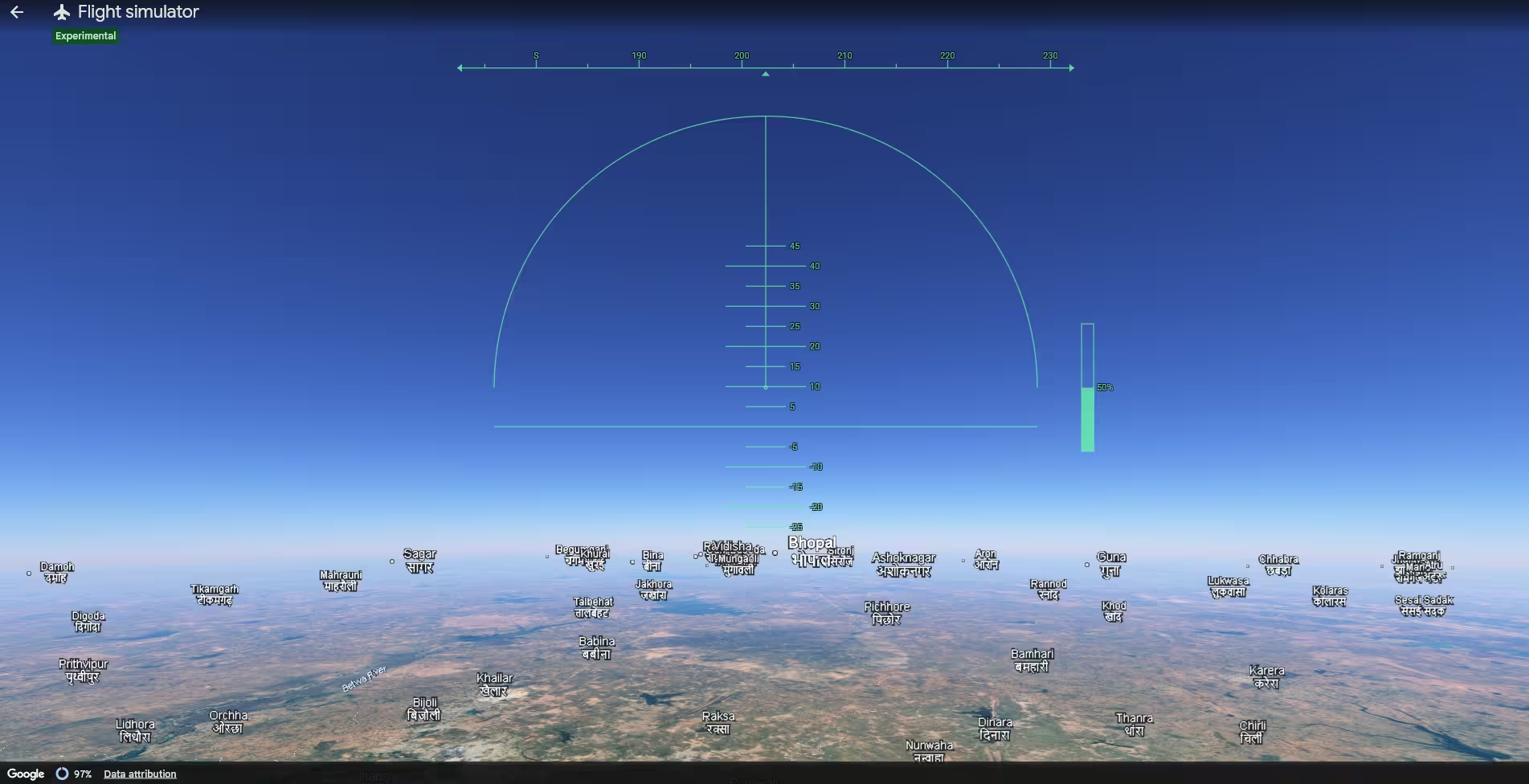
Flight Controls: Keyboard & Mouse
The controls won’t overwhelm you. A few keys handle everything, and you’ll have basic maneuvers down within a couple of attempts. Here’s the complete control reference:
| Action | Key / Input |
|---|---|
| Increase thrust (speed up) | Page Up |
| Reduce thrust (slow down) | Page Down |
| Pitch nose downward | ↑ Up Arrow |
| Pull nose upward (climb) | ↓ Down Arrow |
| Bank / tilt left | ← Left Arrow |
| Bank / tilt right | → Right Arrow |
| Toggle mouse steering | Click in window |
Mouse control is worth trying — once you click inside the simulation window to activate it, your mouse acts as a joystick and feels surprisingly intuitive. Click again to release. If you spiral into the ground (and you probably will on your first flight), a friendly “You have crashed!” message pops up with a one-click button to instantly respawn at a safe altitude.

Which Aircraft Can You Fly?
Right now, the web version of the flight simulator only offers one aircraft: the F-16 Fighting Falcon. If you’ve used the old Google Earth Pro desktop app, you might remember it also included the Cirrus SR22 — a smaller, propeller-driven aircraft that was far more forgiving for beginners.
The SR22 isn’t available in the web version at launch, though Google may add it in future updates. For now, strap in and enjoy the afterburner. Just expect a faster, less forgiving flight model compared to the prop plane.
What This Simulator Won’t Do
Let’s be straightforward about what you’re getting here. This isn’t Microsoft Flight Simulator or X-Plane. Google has intentionally kept the physics simple — the goal is to let you sightsee from the sky in an entertaining way, not to train the next generation of actual pilots. Here’s what’s absent:
- Realistic aerodynamics and stall behavior
- Onboard avionics or instrument navigation
- Dynamic weather or wind
- Multiple aircraft choices (for now)
- Multiplayer sessions
One practical limitation: since terrain and 3D buildings are streamed live over the internet, flying at maximum speed or over dense cities can sometimes cause textures to load slowly. A solid broadband connection helps a lot here.
Want More? Meet GeoFS — The Serious Alternative
If the Google Earth simulator has sparked a genuine interest in browser-based flying, there’s a much more capable option worth knowing about: GeoFS. Built by French developer Xavier Tassin, it runs entirely in the browser, it’s free, and it uses the same satellite globe technology at its core.
✈️ Google Earth Simulator
- 1 aircraft (F-16)
- Simplified physics
- No runways or ATC
- No weather or multiplayer
- Free, instant access
- Best for: casual sightseeing
🌍 GeoFS
- ~30 aircraft to choose from
- 40,000+ real-world runways
- Live weather via METAR data
- Real ADS-B air traffic
- Multiplayer flying sessions
- Best for: serious virtual pilots
GeoFS offers free 10-meter-per-pixel satellite imagery at no cost, with an HD upgrade available for roughly €10/year — solid enough for visual flight rules (VFR) navigation. If you ever want proper instrument approaches, VOR navigation, or flying alongside other real users, GeoFS is where to go next.
See It in Action
Prefer to watch before diving in? We’ve put together a quick walkthrough showing exactly how to access the simulator, launch it, and take your first flight without immediately smacking into a mountain.
Frequently Asked Questions
Should You Try the Google Earth Flight Simulator?
Absolutely — and right now. It takes thirty seconds to launch, costs nothing, requires nothing installed, and delivers a genuinely cool way to see the planet from a pilot’s perspective. It won’t satisfy aviation enthusiasts looking for realism, but as a free, browser-based experience, it’s unexpectedly impressive.
Think of it as Google’s way of turning its incredible satellite atlas into a playable world. Fly over your hometown, trace a river delta, or do an aerial tour of a place you’ve always wanted to visit. Experimental label and all, it’s one of the most fun hidden features Google has shipped in years.
9/10
9/10
4/10
Free ✓


